
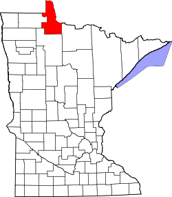
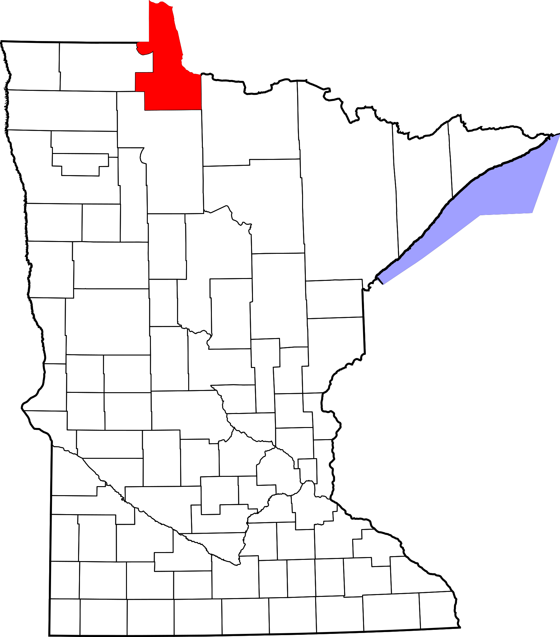
Dosya:Map of Minnesota highlighting Lake of the Woods County.svg

Bu SVG dosyasının PNG önizlemesinin boyutu: 527 × 600 piksel. Diğer çözünürlükler: 211 × 240 piksel | 422 × 480 piksel | 675 × 768 piksel | 900 × 1.024 piksel | 1.800 × 2.048 piksel | 1.045 × 1.189 piksel.
Tam çözünürlük (SVG dosyası, sözde 1.045 × 1.189 piksel, dosya boyutu: 67 KB)
Bu dosya Wikimedia Commons'ta bulunmaktadır. Dosyanın açıklaması aşağıda gösterilmiştir. Commons, serbest/özgür telifli medya dosyalarının bulundurulduğu depodur. Siz de yardım edebilirsiniz. |
Özet
| Açıklama |
English: This is a locator map showing Lake of the Woods County in Minnesota. For more information, see Commons:United States county locator maps. |
| Tarih | |
| Kaynak |
Yükleyenin kendi çalışması: English: The maps use data from nationalatlas.gov, specifically countyp020.tar.gz on the Raw Data Download page. The maps also use state outline data from statesp020.tar.gz. The Florida maps use hydrogm020.tar.gz to display Lake Okeechobee. |
| Yazar | David Benbennick |
Lisanslama
| Ben, bu işin telif sahibi, bu işi kamu malı olarak yayınlıyorum. Bu dünya çapında geçerlidir. Bazı ülkelerde bu yasal olarak mümkün olmayabilir; öyleyse: Ben, bu işi herhangi bir amaç için, herhangi bir şart olmaksızın, yasalarca gerekli olmadıkça, herkesin kullanmasına izin veriyorum. |
Dosya geçmişi
Dosyanın herhangi bir zamandaki hâli için ilgili tarih/saat kısmına tıklayın.
| Tarih/Saat | Küçük resim | Boyutlar | Kullanıcı | Yorum | |
|---|---|---|---|---|---|
| güncel | 02.18, 25 Haziran 2024 | | 1.045 × 1.189 (67 KB) | Nux | fix rendering (remove clipping) |
| 13.14, 12 Şubat 2006 |  | 5.746 × 6.539 (104 KB) | David Benbennick | {{subst:User:Dbenbenn/clm|county=Lake of the Woods County|state=Minnesota|type=county}} | |
| 13.03, 12 Şubat 2006 |  | 5.746 × 6.539 (104 KB) | David Benbennick | {{subst:User:Dbenbenn/clm|county=Lake of the Woods County|state=Minnesota|type=county}} |
Dosya kullanımı
Bu görüntü dosyasına bağlantısı olan sayfalar:
Küresel dosya kullanımı
Aşağıdaki diğer vikiler bu dosyayı kullanmaktadır:
- ar.wikipedia.org üzerinde kullanımı
- bg.wikipedia.org üzerinde kullanımı
- bpy.wikipedia.org üzerinde kullanımı
- cdo.wikipedia.org üzerinde kullanımı
- ceb.wikipedia.org üzerinde kullanımı
- cy.wikipedia.org üzerinde kullanımı
- da.wikipedia.org üzerinde kullanımı
- de.wikipedia.org üzerinde kullanımı
- en.wikipedia.org üzerinde kullanımı
- List of counties in Minnesota
- Lake of the Woods County, Minnesota
- Baudette, Minnesota
- Baudette Township, Lake of the Woods County, Minnesota
- Boone Township, Lake of the Woods County, Minnesota
- Chilgren Township, Lake of the Woods County, Minnesota
- Forest Area Township, Lake of the Woods County, Minnesota
- Gudrid Township, Lake of the Woods County, Minnesota
- Kiel Township, Lake of the Woods County, Minnesota
- Potamo Township, Lake of the Woods County, Minnesota
- Prosper Township, Lake of the Woods County, Minnesota
- Rapid River Township, Lake of the Woods County, Minnesota
- Rulien Township, Lake of the Woods County, Minnesota
- Spooner Township, Lake of the Woods County, Minnesota
- Swiftwater Township, Lake of the Woods County, Minnesota
- Victory Township, Lake of the Woods County, Minnesota
- Wabanica Township, Lake of the Woods County, Minnesota
- Walhalla Township, Lake of the Woods County, Minnesota
- Wheeler Township, Lake of the Woods County, Minnesota
- Williams, Minnesota
- Zippel Township, Lake of the Woods County, Minnesota
- Lakewood Township, Lake of the Woods County, Minnesota
- McDougald Township, Lake of the Woods County, Minnesota
- Myhre Township, Lake of the Woods County, Minnesota
- Roosevelt, Minnesota
- Township 157-30, Lake of the Woods County, Minnesota
- Township 158-30, Lake of the Woods County, Minnesota
- Northwest Angle
- Angle Inlet, Minnesota
- Oak Island (Minnesota)
- Red Lake Indian Reservation
- Clementson, Minnesota
- Graceton, Minnesota
Bu dosyanın daha fazla küresel kullanımını görüntüle.